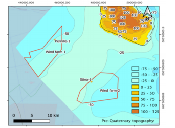
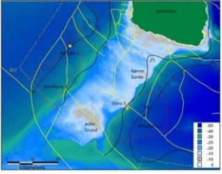
Survey West of Bornholm
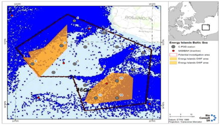
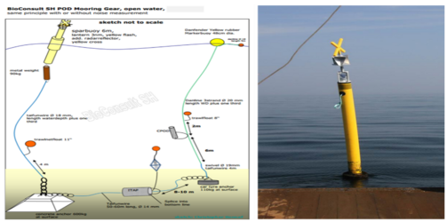
Energinet has deployed 15 C-POD stations in the area around the two designated areas for the two new wind farm areas approx. 20 km Southwest and South of Rønne. The C-POD stations have been selected to cover the entire area, so that it can be investigated how the marine mammals use the area. The C-POD stations will be in operation for 24 months to cover all seasons and variations between years. The stations will be serviced mid-season to guarantee one month of data per season. The stations and the individual C-PODS are equipped with GPS locating equipment so that they can be located in the event of their disappearance.
54°50.34'N, 14°16.46'E
54°52.97'N, 14°07.06'E
54°58.82'N, 14°19.80'E
55°06.77'N, 14°25.42'E
54°53.09'N, 14°25.76'E
54°58.50'N, 14°30.37'E
55°02.99'N, 14°38.76'E
54°46.37'N, 14°30.42'E
54°51.47'N, 14°37.47'E
54°58.54'N, 14°44.43'E
54°51.32'N, 14°51.62'E
54°56.77'N, 14°56.13'E
54°42.34'N, 14°35.23'E
54°42.37'N, 14°44.54'E
54°47.76'N, 14°44.50'E